

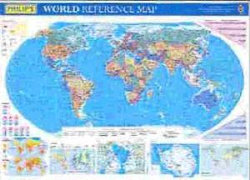
This brightly-coloured wall chart has been fully updated for 2005, and includes the new South African names for Pretoria (Tshwane) and Durban (eThekwini). The World is shown in political colours at a scale of 1:37 300 000 (600 miles to 1 inch), with clear lettering and symbols for easy reference. Individual countries are picked out in distinctive colours to aid identification, with city and town names clearly shown, as well as roads, railways, airports, rivers and sea contours.Smaller-scale physical maps of the Arctic and Antarctica are also included, together with a series of thematic maps beneath the main map showing world time zones, climate and relief of land, plus climate graphs and population and distance charts.This wall chart is available in two versions:(a) laminated on one side and rolled into a clear plastic tube for use as a wall map; and(b) unlaminated and folded with a tipped-on card cover for use when travelling.It is ideal for mounting on a study wall or in the workplace - the clarity of the maps ensures that it is highly accessible for business purposes and general reference.Main map scale:



Share This Book: